Power of Geospatial Science: Promise and Peril
National Science Week at The Royal Society of Victoria
The Power of Geospatial Science: Promise and Peril - Thursday 20 August

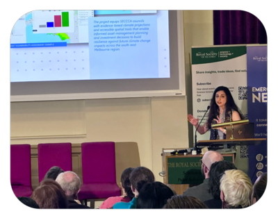
The Ellery Theatre was once again filled to capacity for Geography Victoria’s The Power of Geospatial Science: Promise and Peril symposium. Five outstanding speakers explored the extraordinary potential of geospatial science, as well as some of the challenges and risks that come with AI and the increasingly powerful location-based technologies. The audience included geospatial professionals, university and secondary students, teachers and members of the wider community, creating a wonderfully diverse and engaged gathering.
Presented by Geography Victoria as an Inspiring Victoria event, with support from the Royal Society of Victoria, the symposium highlighted the vital role geography plays in understanding our changing world.
Our sincere thanks to our speakers:
 Alena Moison – Director, Vicmap, Department of Transport and Planning
"Capture once, use by many: the case for foundation spatial data as public infrastructure."
Alena works with spatial data, digital technology and mapping to help government make better decisions. Alena previously worked on the Digital Twin Victoria program, which brought together detailed information about places, infrastructure and communities across the state. She is especially interested in making complex geospatial information useful, accessible and engaging for a wider audience.
>> View Alena Moison's presentation
 Kirk Mitchell - Director of Geo Partnerships at Google (Google Maps, Local Search & Google Earth) and Adjunct Professor with RMIT University, Geospatial Sciences Department
"AI for the Planet: How Google Maps is addressing the climate challenge"
Kirk Mitchell is a seasoned executive passionate about using technology to drive a safer, sustainable and more efficient world. He believes that to lead is a responsibility to bring the absolute best out of people through creating a culture of inclusion, accountability and curiosity. Kirk has over 30 years’ experience working for many of the world's leading mapping companies with placements in Gent (Belgium), Singapore, Berlin and San Francisco. Kirk is also an elite triathlete, representing Australia at 6 World Championships including the Hawaiian Ironman.
>> View Kirk Mitchell's presentation
 Dr Jathan Sadowski – Associate Professor, ARC Future Fellow, Emerging Technologies Research Lab – Monash University
“The political economy of geospatial catastrophe modelling and marketisation of climate risk knowledge, with special attention to Victoria and Melbourne”
The focus of Jathan’s study is the political economy of information technology and risk governance with a focus on the insurance industry. His current project – funded by a Future Fellowship from the Australian Research Council – focuses on critically studying the polycrisis of insurance insecurity and climate risk governance. He is especially interested in analysing the political, economic and sociotechnical systems that influence the construction, power, and value of knowledge about climate risk, and that mediate the relationships between the (re)insurance industry, risk modellers, local governments, and vulnerable communities.
>> View Dr Jathan Sadowski's presentation
 Dr Amy Griffin – Senior Lecturer in Geospatial Science, RMIT University
“How humans and machines make maps … for humans and machines.”
Amy is a broadly trained geographer whose primary speciality is cartography. Her work often engages with the end users of spatial information products (like maps) and spatial information systems. Amy’s current focus is working with Australia's fire response services to develop new designs for bushfire spread prediction maps. She also has active research investigating next-generation multi-hazard warning platforms and how maps might be integrated into those platforms. Amy is one of the current Vice-Presidents of the International Cartographic Association.
>> View Dr Amy Griffin's presentation
 Mina Jahanshahi - Data Insights and Solutions Leader at Veris Australia
“How we are using spatial data to reduce expenditure for infrastructure management.”
Mina is a spatial professional with over fifteen years of experience in the GIS consulting industry. She is the Data Insights & Solutions Leader, working in both technical and people management roles. Mina is the 2023 Thornton Smith Medallist and the 2018 Victorian Young Spatial Professional of the Year.
>> View Mina Jahanshahi's presentation